- Place de l'Hôtel de ville
15300 MURAT - +33 4 71 20 09 47
- contact@hautesterrestourisme.fr

Neussargues en Pinatelle
Loop
14.4km
4h
Yellow markings.
387m
You’ll have to choose between Neussargues or Chalinargues as your starting point for this beautiful stroll through a forest along a medieval trail dotted with wayside crosses, a medieval tower, rock shelters, a waterfall, sarcophagi and Romanesque churches…
-For your safety, please check the weather forecast before setting off on your hike. -To preserve the environment in which you are located, please avoid leaving garbage in nature. -Remember to take the appropriate equipment for the weather conditions and the hiking itinerary (hiking boots, water bottle, cap, sunglasses, jacket…).
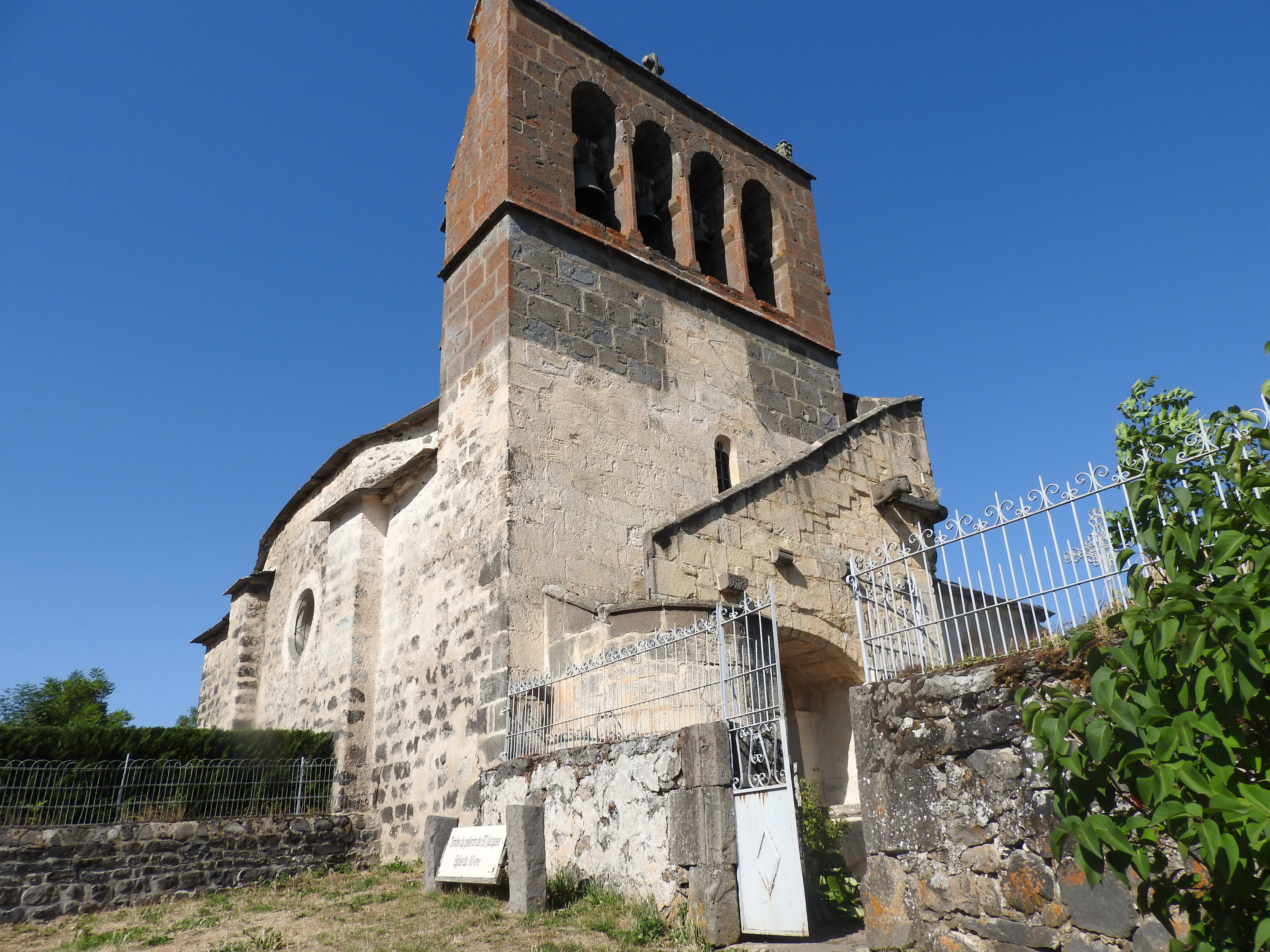
Along the way, you’ll discover a rich heritage, some of which is listed as a Monument Historique. These include the Mons Cross (15th century), the churches of Moissac (12th century) and Chalinargues (12th century), and Merovingian sarcophagi.
Start – The starting point is in Chalinargues, on the small square before the town hall. Opposite the start sign, take the road to the right (D23) and walk up towards the village for 100 m (wash-houses on your right). Turn right just before the stop sign and take the lane leading to the D39. Continue straight ahead for approx. 500 m.
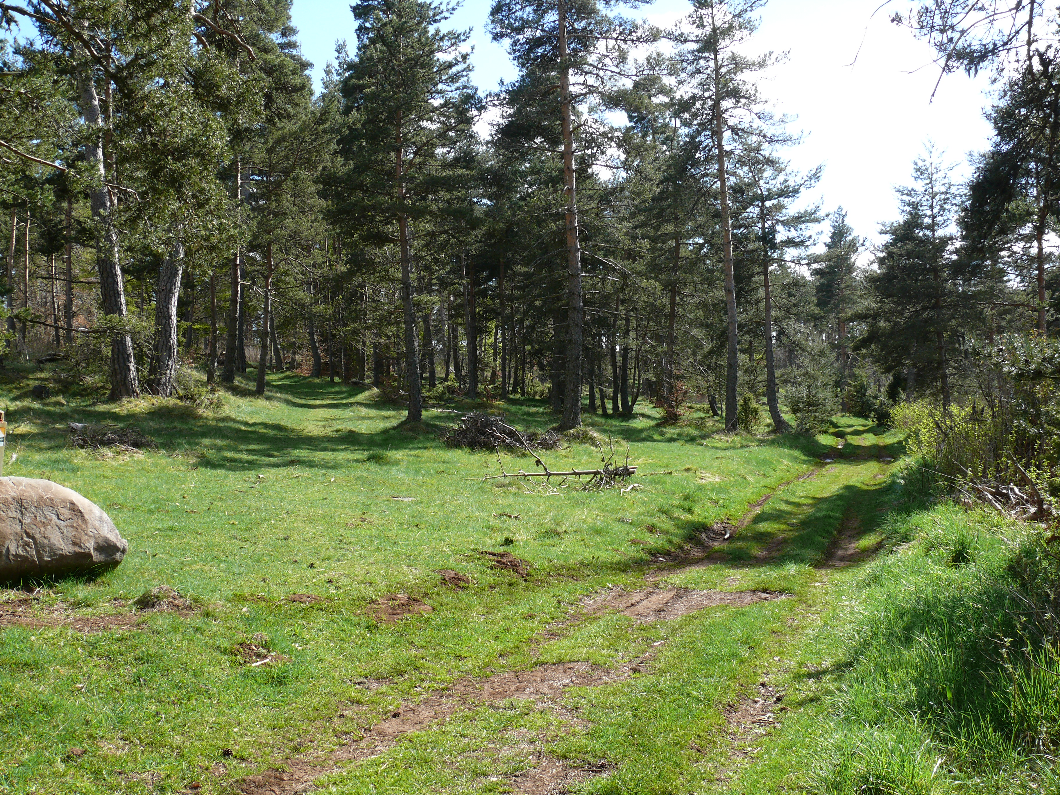
1- Take the track on your right which runs between meadows. After about 750 m, cross the road and continue on the track opposite for another 750 m, cross the Longuit stream and go straight ahead. The narrower track rises and leads to Mons.
2- In the hamlet of Mons, note the 15th-century cross, listed as a Monument Historique. On its racket sits Christ and the Virgin and Child. Cross the main square and notice the water troughs. Pass the Maison de Lestrade and go straight ahead. When the track bends to the right, continue straight ahead on the grassy path. Cross a fence and then a V-shaped chicane.
3- At this point (view of Rocher de Laval), the track descends the hillside. After the hairpin bends, continue straight ahead towards the Château de Moissac (16th century).
4- Turn left, cross the disused railroad line and enter the village of Moissac. Pass the church (12th century) and take the road (D23) downhill. On leaving the village: Carolingian and Merovingian sarcophagi dating from the 6th and 7th centuries.
5- Continue straight ahead on the D23, ignoring the track on your right and taking the next road on your right. Continue straight ahead on the track which runs alongside the railroad line on your right, cross it by a bridge and continue straight ahead for 1.2 km until you reach the prehistoric caves of Cuzers (a small path on the right leads up to the site (10 min. round trip). Continue straight ahead to enter the Bois du Cheylat, which you cross for 2 km on a path lined with mossy stones, then on a track leading to the D40. Follow the road for 300 m.
6- Take the right-hand track for 250 metres. At the crow’s feet, turn left to reach the village of Freissinet. Pass the bread oven on your left and follow the road (D40) for 300 meters.
7- At a crossroads, leave the road and take the left-hand track. Continue straight ahead, crossing two successive roads.
8- At the third road, turn right to reach Chalinargues and the starting point, passing the 12th-century church.
All year round.
Subject to favorable weather.
Pets allowed
Environments
Waterfall view, Village centre, In the country, Forest location