- Place de l'Hôtel de ville
15300 MURAT - +33 4 71 20 09 47
- contact@hautesterrestourisme.fr

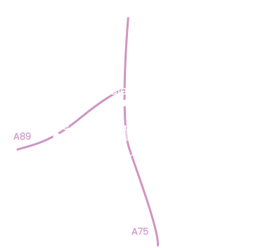
Auriac-l’Église
Loop
10.2km
3h
Yellow markings
430m
Après le moulin où l’on fabriquait l’huile et la farine, et Auriac-haut, point fort architectural du circuit, les murets en pierres sèches vous escortent puis laissent place aux sentiers plus abrupts des gorges du ruisseau de l’Eglise.
-For your safety, please check the weather forecast before setting off on your hike. -To preserve the environment in which you are located, please avoid leaving garbage in nature. -Remember to take the appropriate equipment for the weather conditions and the hiking itinerary (hiking boots, water bottle, cap, sunglasses, jacket…).
Departure- Place d’Auriac-Bas. Cross the Sianne bridge and go up to Auriac-Haut. Go back down, leaving the church on your right. When you reach the bridge, the lintel of the house indicates that it was a mill where oil and flour were made. Just before the bridge, turn right onto the D55, following it for around 600m.
1- Leave it for a track which rises to the right.
2- At the jardinets, turn right onto a gently sloping track. Cross a wood, in which an old lime quarry is slightly visible on the right. At the end of the wood, turn right onto a grassy track. Before reaching the hamlet of Villeneuve, there is a view of the Sianne valley and Auriac l’Eglise on the right. At the hamlet of Villeneuve, take the road. Follow it to La Bastide.
3- Cross this hamlet, then leave the road and turn left up the carriage road. After the first hairpin, see the bubbly volcanic rock on the right as you climb up. Follow the track.
4- At the crossroads, turn right to reach the road. Viewpoint to the left of the Monts du Livradois. Continue along this road to reach the hamlet of Bousseloeuf.
5- In the middle of the hamlet, turn left into a farmyard. Leave the track on your left. View opposite to the Giniols breach (1307m). Leave an old pond lined with low walls on the right. At the fork, turn left at the old walled garden. Before entering a meadow, take the small hedge-lined path on the left. It leads to the D21.
6- Take this road on your right for 150 meters, this is the old Gallo-Roman road.
7- Leave it and take the first gravelled track on your right. Shortly afterwards, go down to the edge of a meadow on a sunken track.
8- Opposite the entrance to a meadow, turn right at a right angle. At the fork in the road, continue straight ahead, with numerous holly bushes decorating the hedges. Descend into the undergrowth on a winding path.
9- After a steep section, you come to a forest track. Follow it for 500 metres to the right. The track crosses a young plantation and then gets lost.
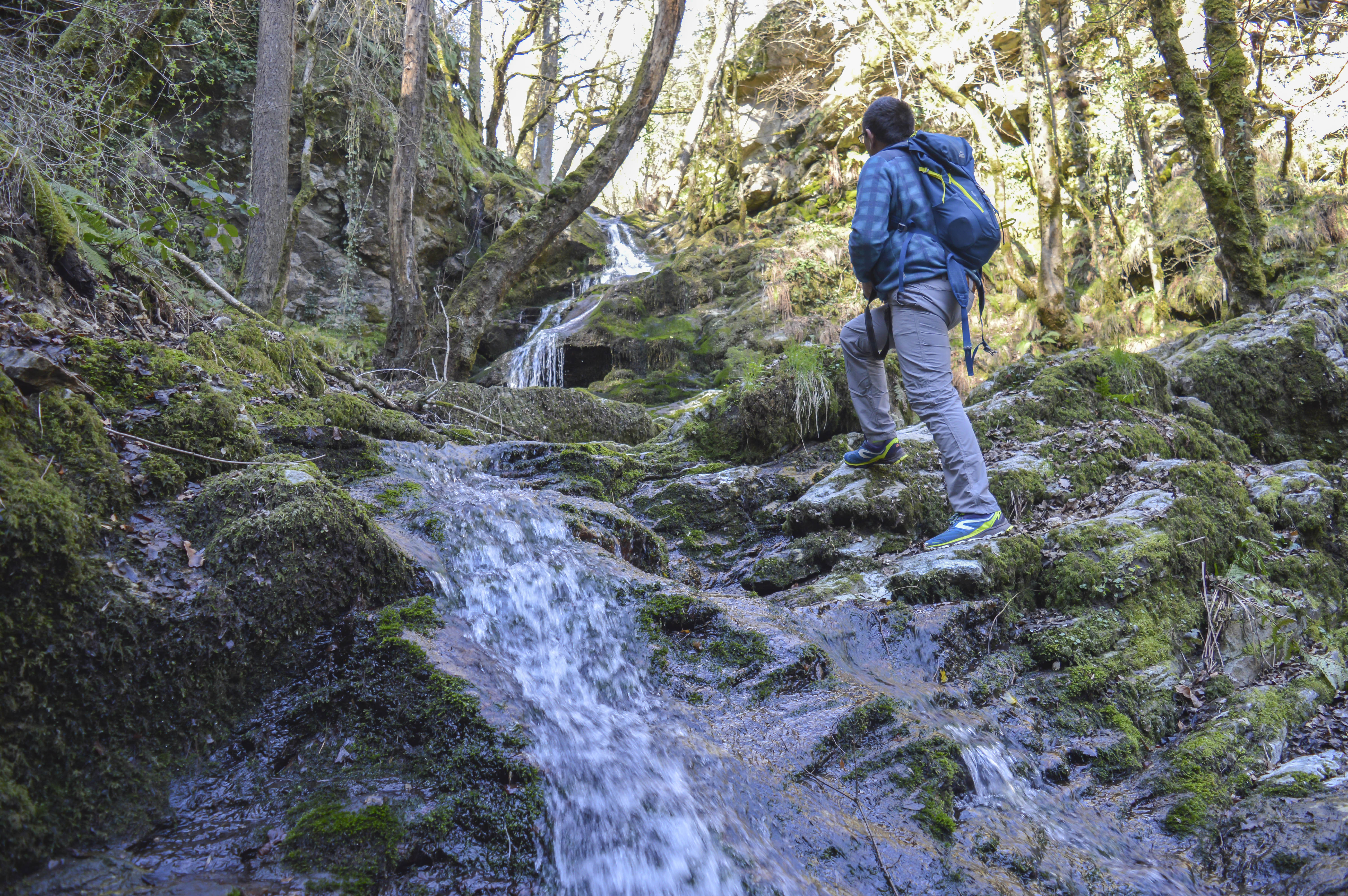
10- Turn left, follow the small ravine and cross the ruisseau de l’église.
11- Turn left after the stream to reach the waterfall (approx. 15 min return). Alternatively, turn right. Go through a gate. The path follows the stream as far as Auriac-Haut. Return to the starting point. Just before the church, notice the dovecote on your left.
All year round.
Subject to favorable weather.
Pets allowed Tenus en laisse
Environments
In the country, Overview on river, Waterfall view